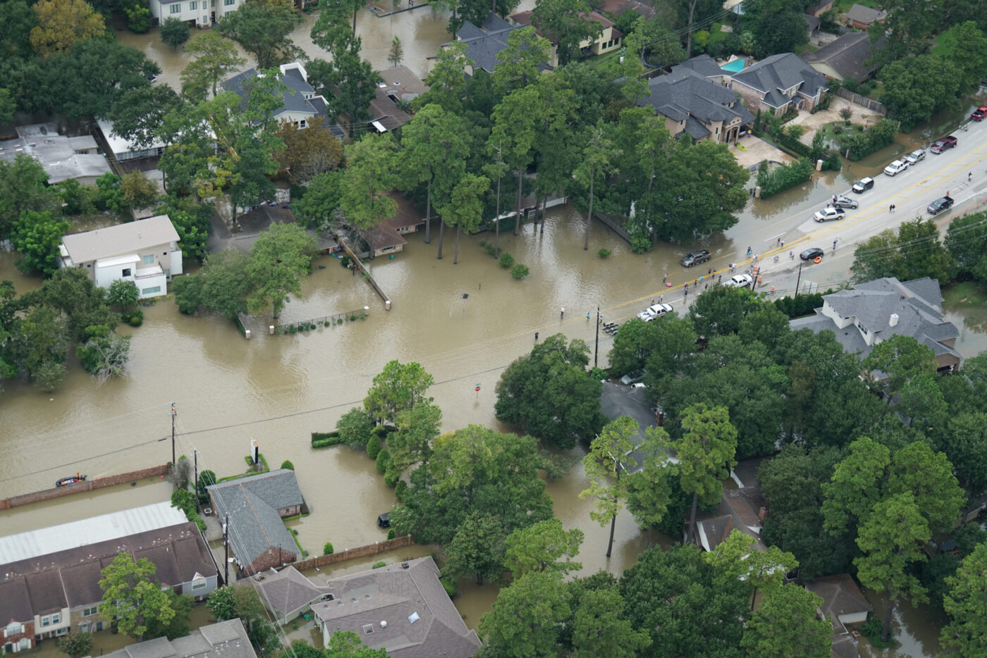
Hurricane Harvey made landfall in Texas as a Category 4 hurricane on August 25, 2017, near Port Aransas. In less than a week, some areas received over 50 inches of rain – surpassing the average annual rainfall of 45 inches for the Houston-Galveston Bay region. The resulting flood caused widespread devastation, impacting lives across the Greater Houston area. Hurricane Harvey brought environmental challenges, including storm related spills, pollution, Superfund site impacts, and disturbances to water quality, air quality, and power generation.
In response, HARC quickly mobilized to acquire and process critical data related to these environmental impacts. The analysis is presented through narrative summaries, maps, and infographics in the story map, Summarizing Hurricane Harvey’s Environmental Impacts.
As part of this work in 2017, HARC also developed the datasets listed below in response to the severe impacts of Hurricane Harvey on the Greater Houston area.
Please note: the data, maps, and links provided here have not been updated since 2017 and are maintained for historical and reference purposes.
Click on the links below to download the relevant data as shown in the Hurricane Harvey app.
If you have any questions about this data, please contact HARC’s GIS team at [email protected]
Thank you to our project partners: National Oceanic and Atmospheric Administration, United States Geological Survey, National Weather Service, Vieux Inc., Texas Parks & Wildlife Department, Texas Commission on Environmental Quality, Environmental Defense Fund, Environmental Protection Agency, U.S. Coast Guard National Response Center, Federal Emergency Management Agency, Department of Energy, Electric Reliability Council of Texas (ERCOT), Texas A&M University, Department of Soil and Crop Sciences, University of Houston – Clear Lake, College of Science and Engineering, Texas General Land Office – Beach Watch Program, Galveston Bay Foundation, Texas A&M University Galveston – Department of Marine Biology, and the City of Houston Health Department via Urban Data Platform (Kinder Institute).