By Ryan Bare, PhD, Research Scientist, Watershed Ecology
The Houston area is a complex system comprised of a three-dimensional environment that forms a mosaic of natural and urban features when viewed from above. However, characteristics of the vegetation canopy, defined by this project as trees and shrubs greater than 9.85 feet (3 meters), can vary vastly over short distances. The advent of Light Detecting and Ranging (LiDAR) technology has made the fine scale mapping of detailed three-dimensional land surface characteristics, over large-scale geographies, a feasible endeavor.
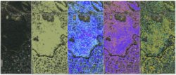
This project derived a series of vegetation canopy data from LiDAR collected in 2018 by Fugro USA Land through the Texas Strategic Mapping Program. Spatial differences of vegetation coverage as well as a comprehensive shrub/tree canopy assessment was produced by quantifying and mapping structural properties of the shrub/tree canopy within Harris County, Texas. High resolution data layers were generated including canopy coverage, a canopy height model, canopy density, and a vertical structural complexity index (below). The high-resolution layers were summarized by census tract to reveal county wide patterns of canopy coverage and structure.
The A Vegetative View: Harris County, Texas web-based mapping application was developed to house the high-resolution vegetation canopy coverage layer and summarized versions of the structural layers. Use this application to increase your shrub/tree canopy knowledge by gaining an understanding of where, in the most populated county of the state, vegetation is present as well as how dense and tall it may be. If you are interested in more information or the full resolution data, contact Dr. Ryan Bare at [email protected].
A Vegetative View: Harris County, TX
When Technology and Nature Collide: LiDAR and the Importance of Tree Canopy in the Water Cycle
When Technology and Nature Collide: LiDAR and the Importance of Biodiversity
Support for this project was provided by a grant from the Houston Endowment.
Houston Endowment is a private philanthropic institution that works across the community for the benefit of the people of greater Houston.
With assets of over $1.8 billion, the foundation provides approximately $70 million in funding each year in order to enhance civic assets, strengthen systems that support residents, promote post-secondary success, and build a stronger region. Established by Jesse H. and Mary Gibbs Jones in 1937, Houston Endowment has a rich legacy of addressing some of greater Houston’s most compelling needs. Today the foundation continues efforts to create a vibrant community where all have the opportunity to thrive.